


インドネシア
地図-インドネシア-カリマンタン州(Kalimantan)

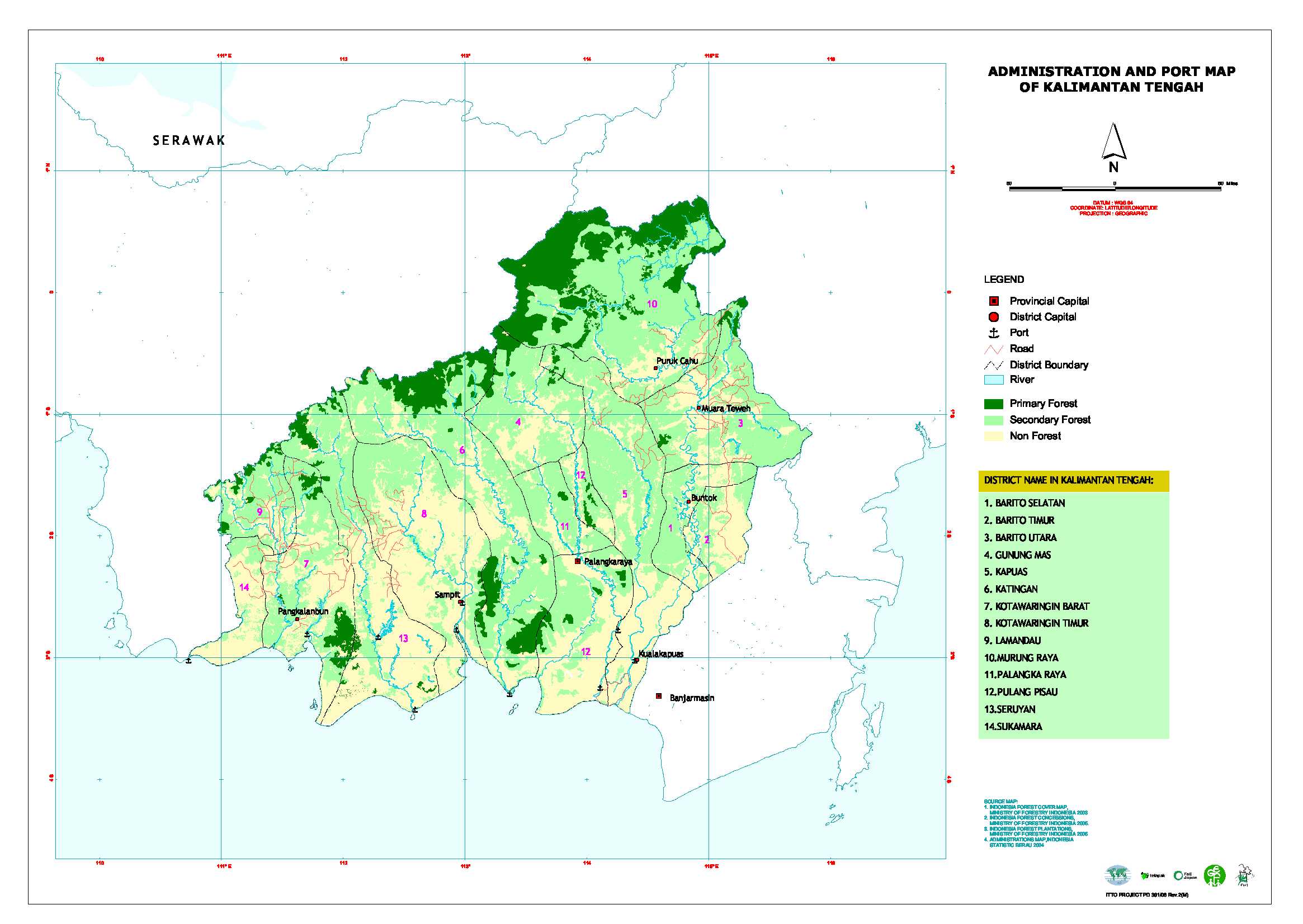
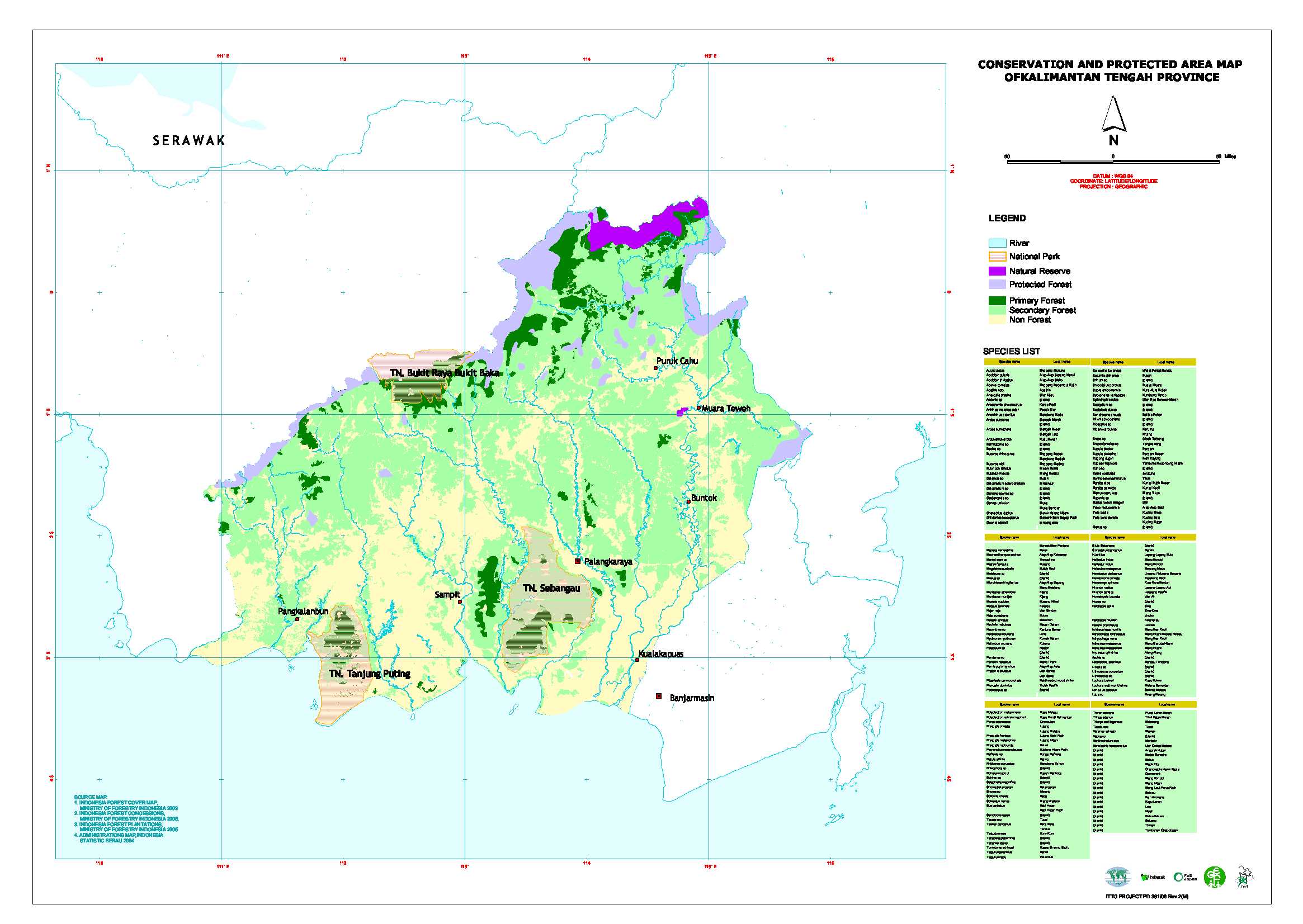
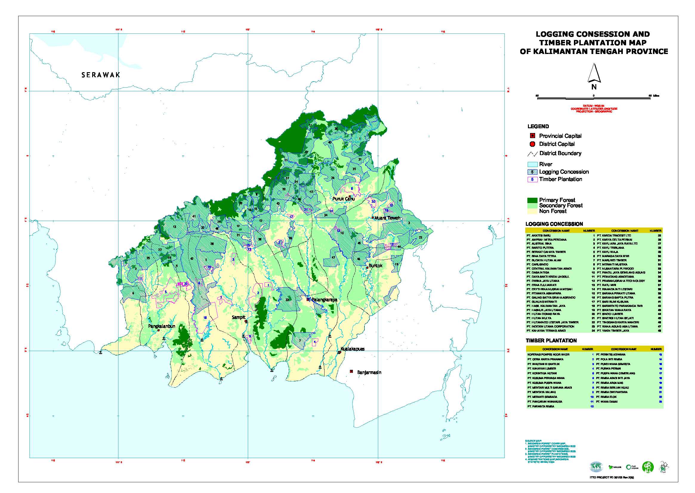
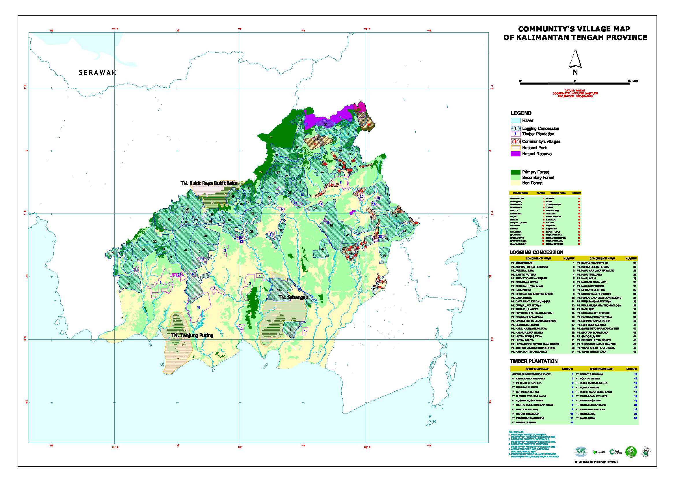
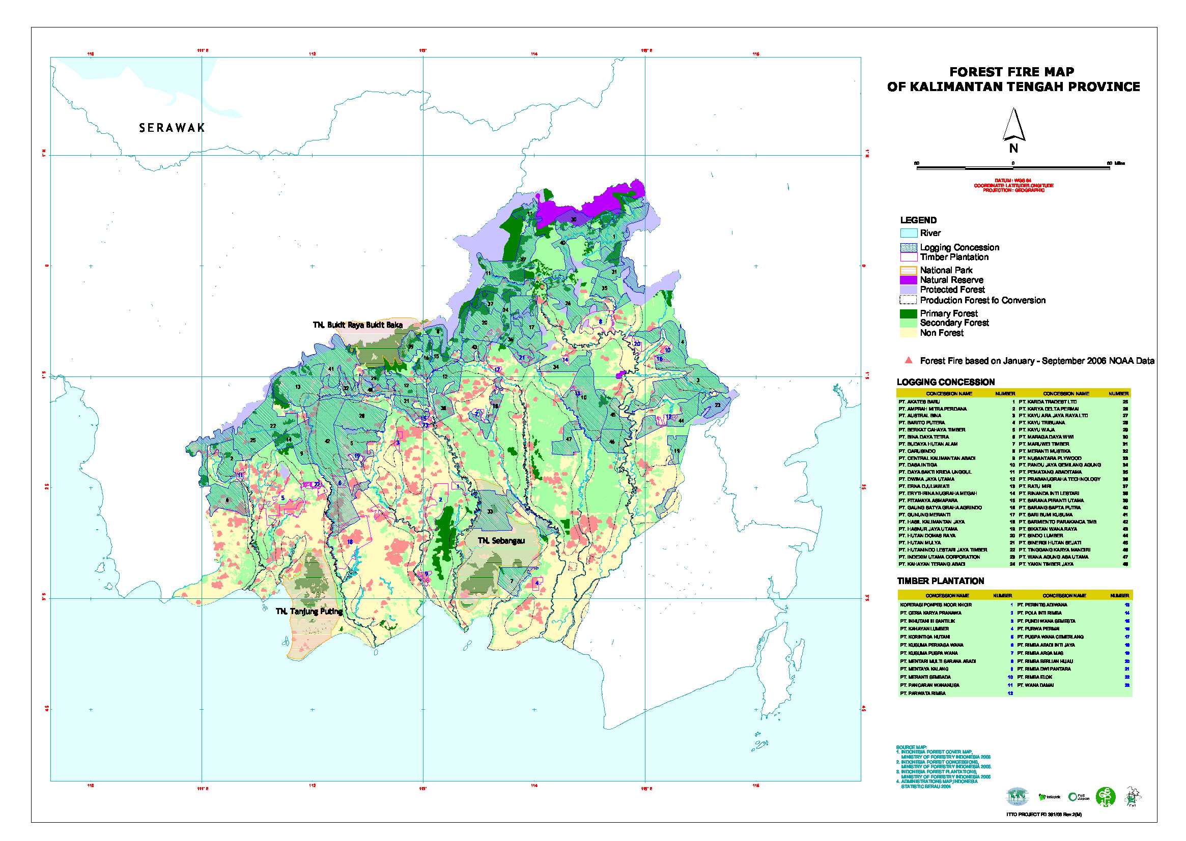
地図-インドネシア-中カリマンタン州(Kalimantan Tengah)
| 行政区分(Administration map) |
保全林と保護林 (Conservation and protected area map) |
 |
 |
天然林伐採コンセッションと人工林地域 (Logging concession and forest plantation map) |
先住民居住地域 (Community's village map) |
 |
 |
過去に森林火災が発生した箇所の分布 (Forest fire map) |
|
 |
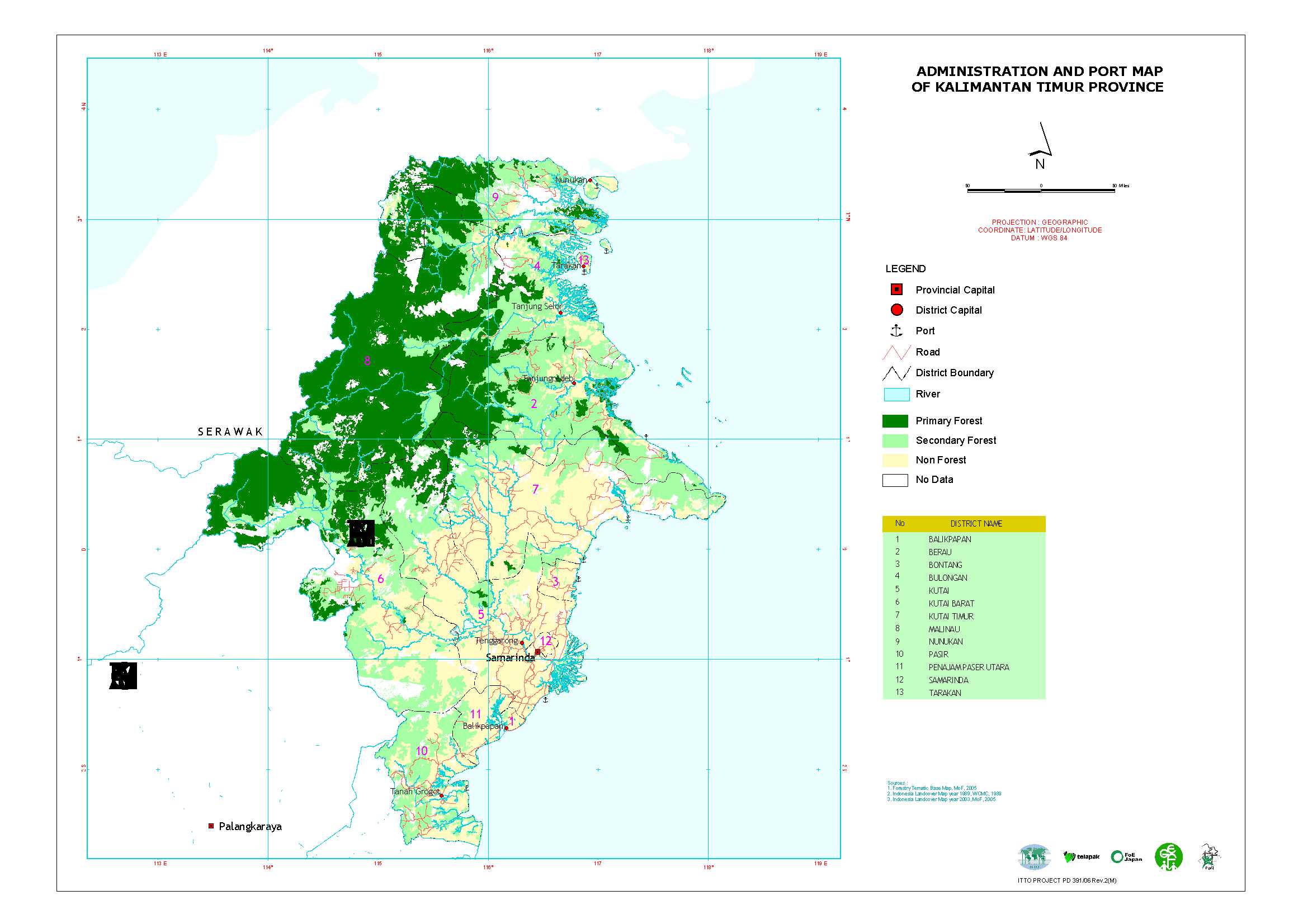
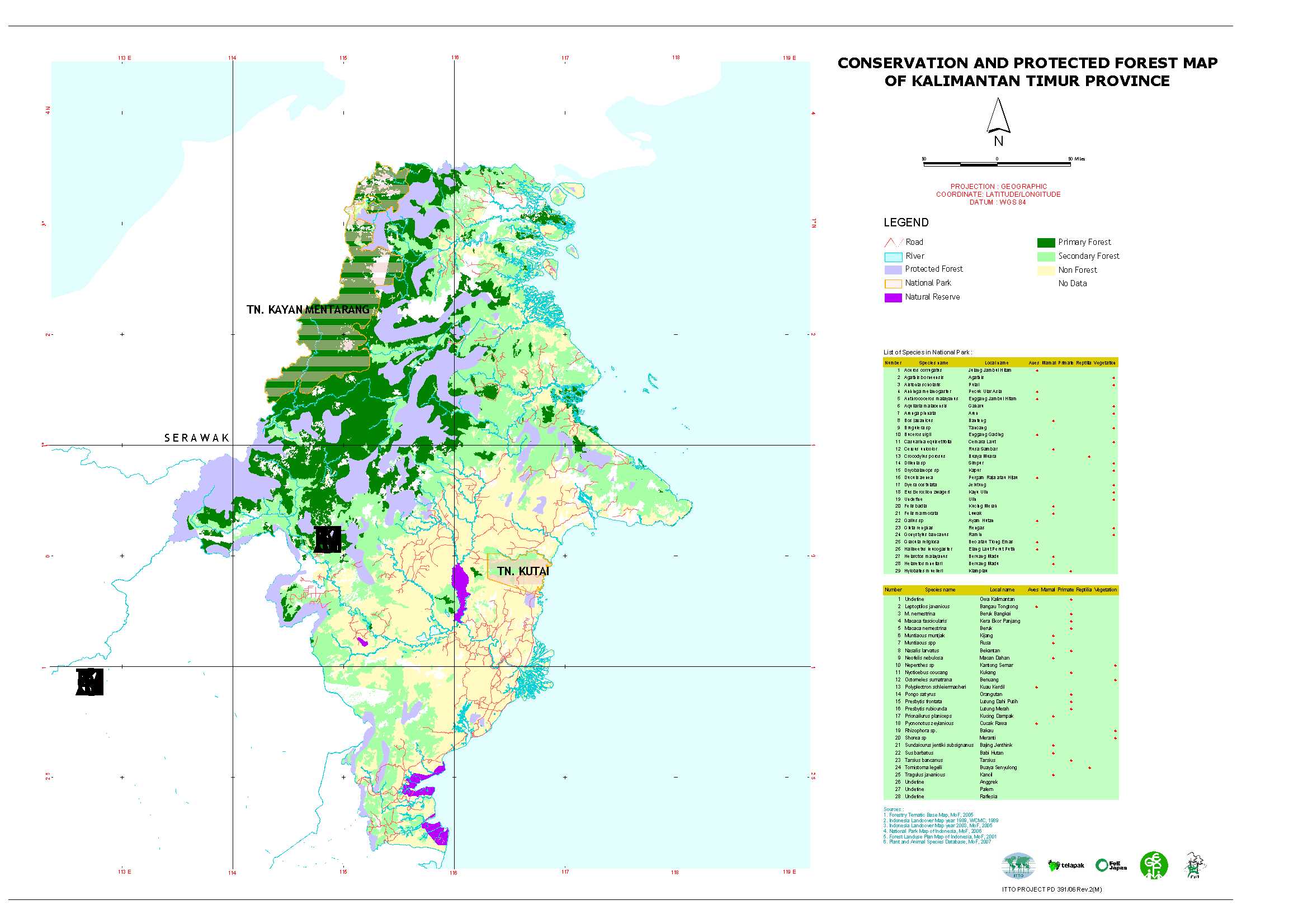
地図-インドネシア-東カリマンタン州(Kalimantan Timur)
| 行政区分(Administration map) |
保全林と保護林 (Conservation and protected area map) |
 |
 |
天然林伐採コンセッションと人工林地域 (Logging concession and forest plantation map) |
過去に森林火災が発生した箇所の分布 (Forest fire map) |
 |
 |
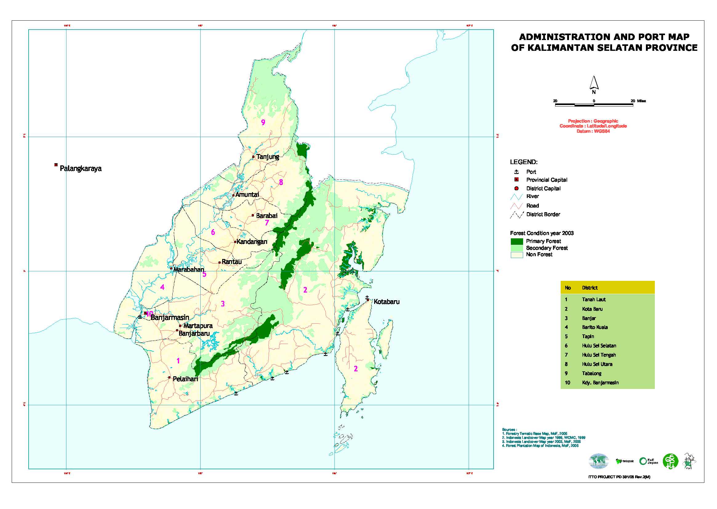
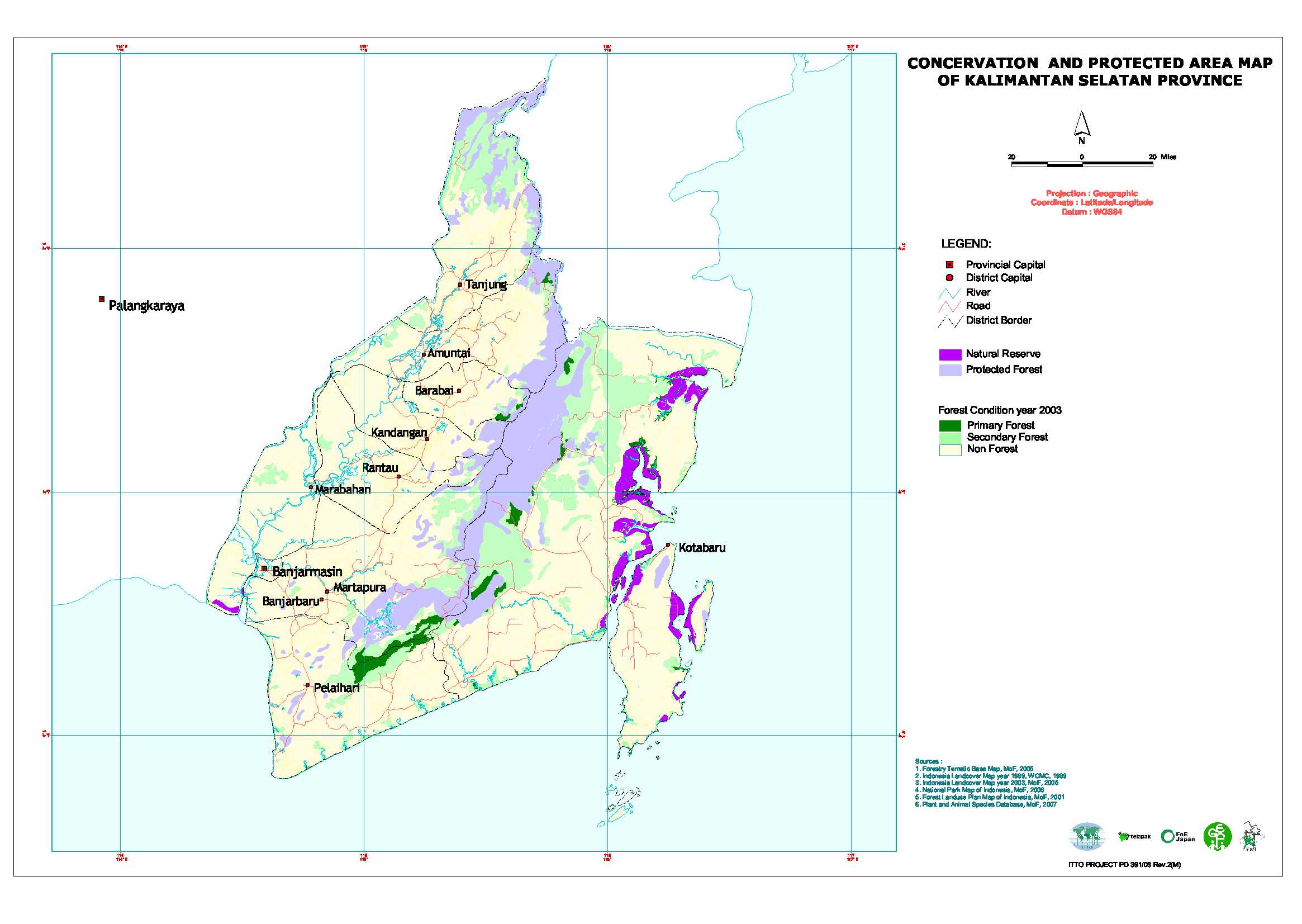
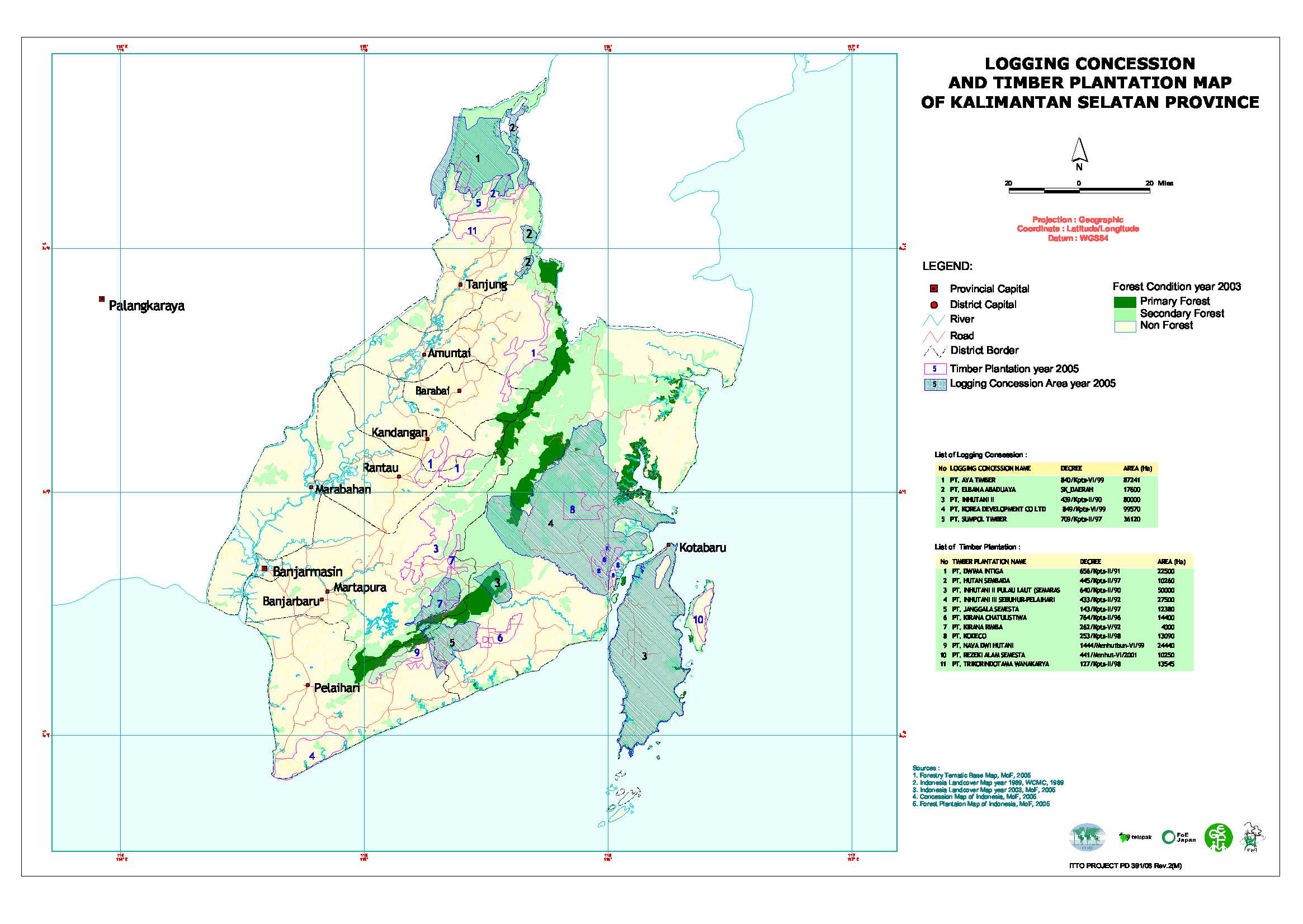
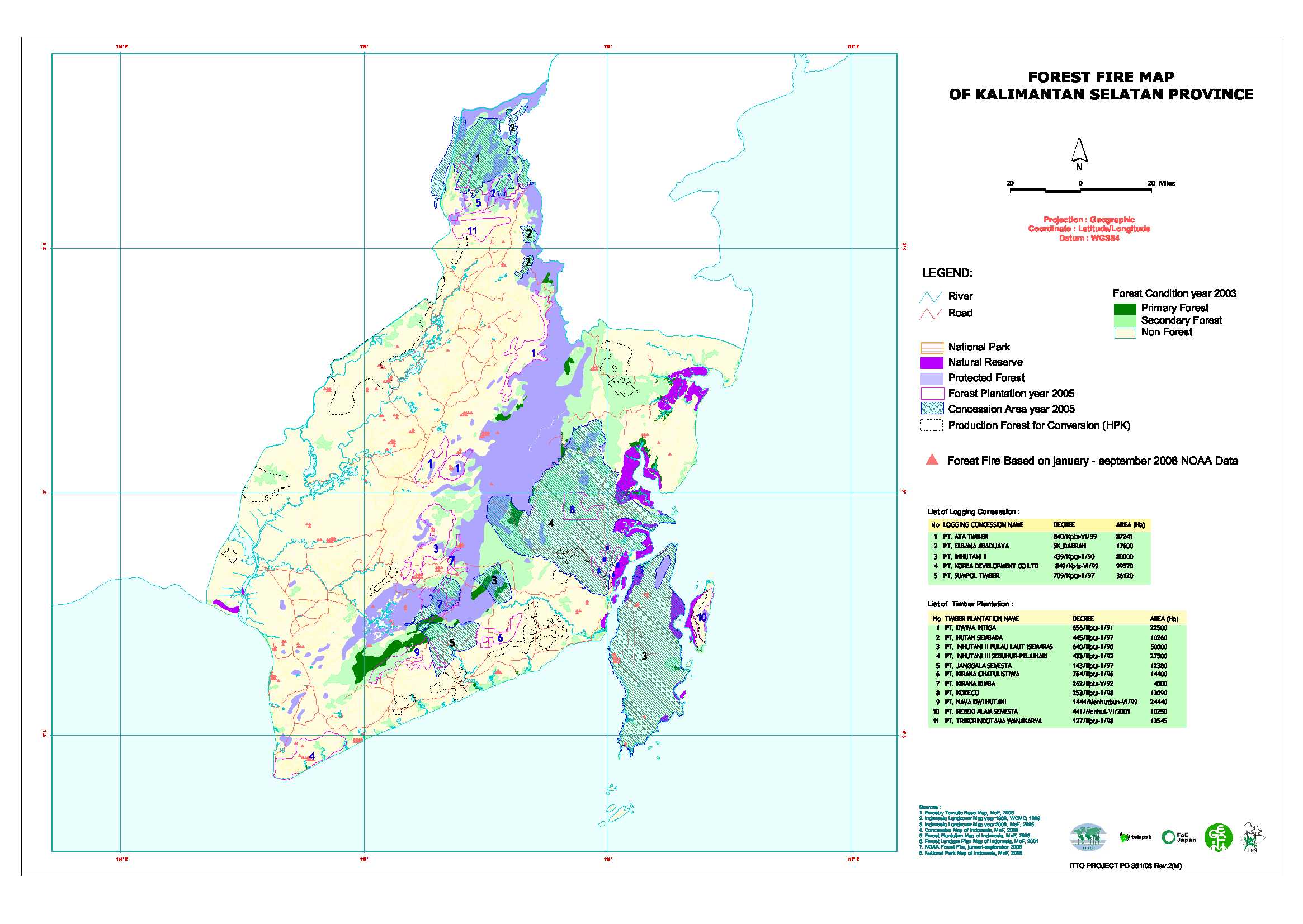
地図-インドネシア-南カリマンタン州(Kalimantan Selatan)
| 行政区分(Administration map) |
保全林と保護林 (Conservation and protected area map) |
 |
 |
天然林伐採コンセッションと人工林地域 (Logging concession and forest plantation map) |
過去に森林火災が発生した箇所の分布 (Forest fire map) |
 |
 |
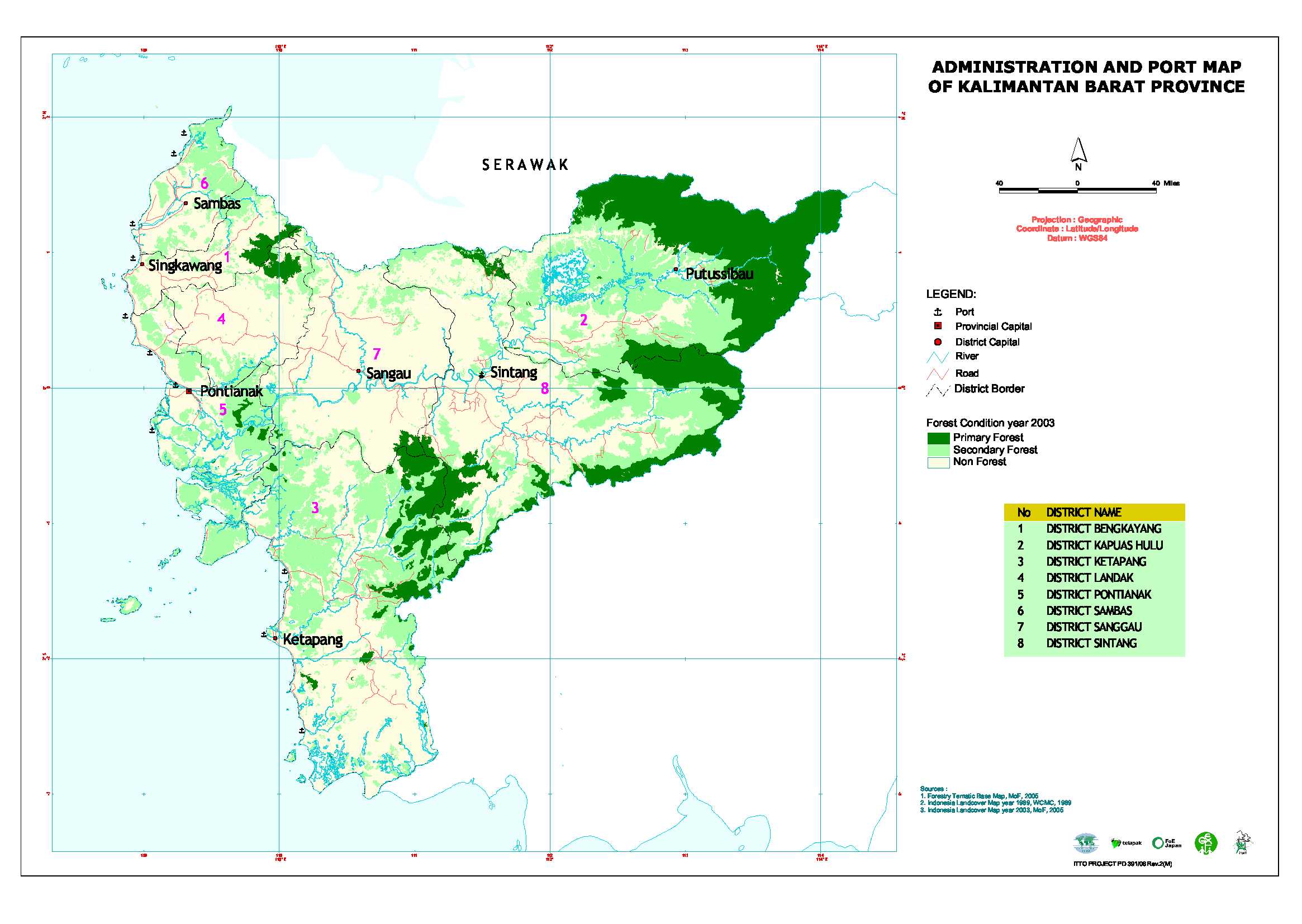
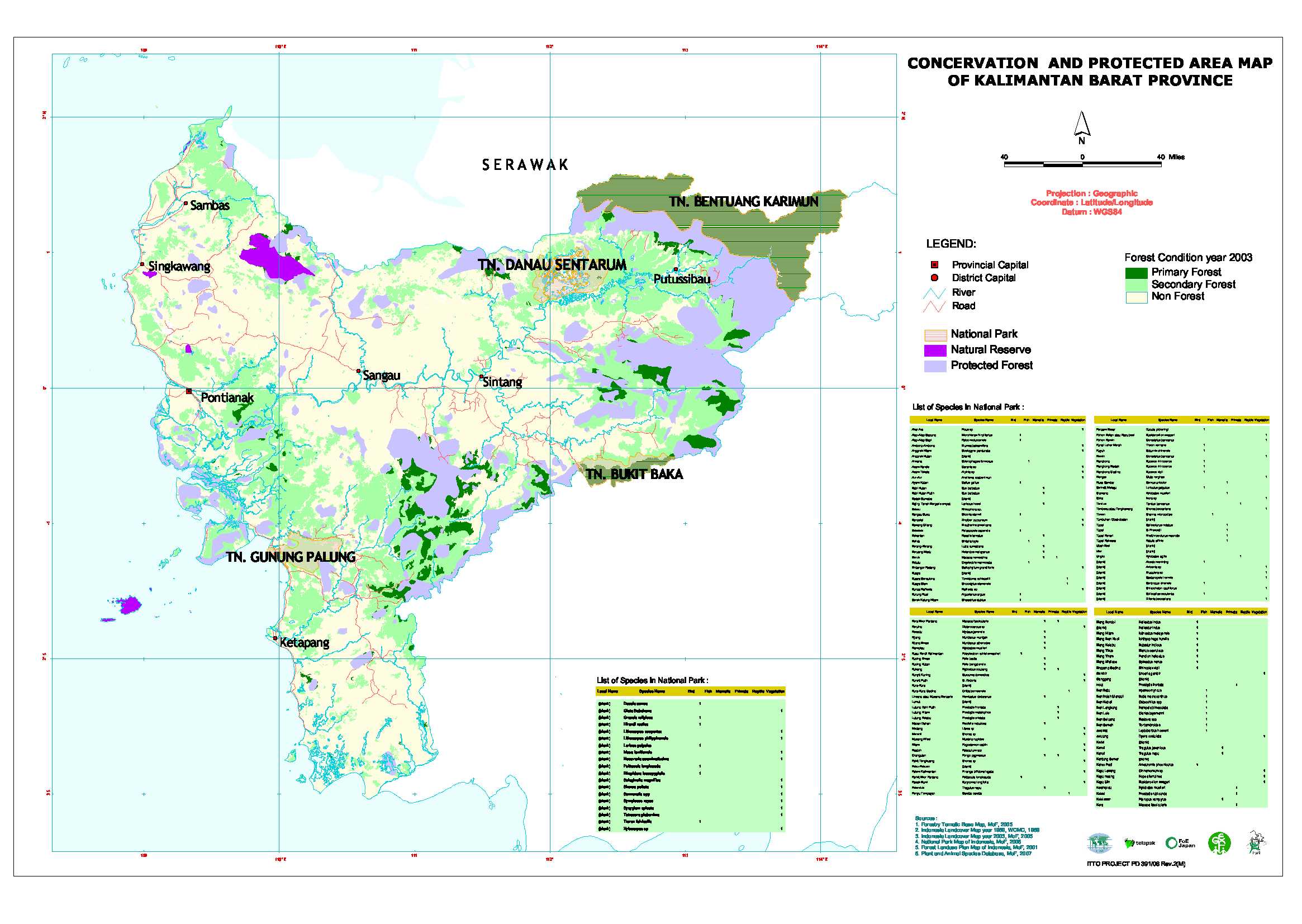
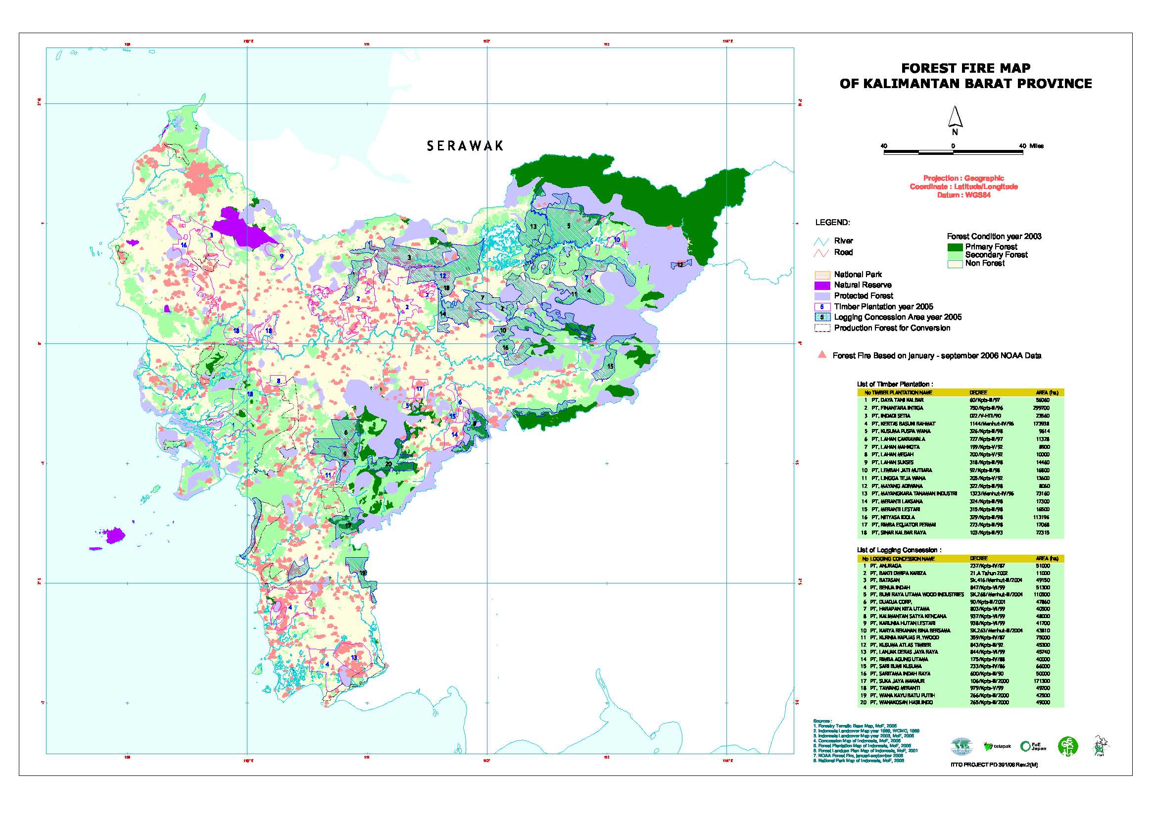
地図-インドネシア-西カリマンタン州(Kalimantan Barat)
| 行政区分(Administration map) |
保全林と保護林 (Conservation and protected area map) |
 |
 |
天然林伐採コンセッションと人工林地域 (Logging concession and forest plantation map) |
過去に森林火災が発生した箇所の分布 (Forest fire map) |
 |
 |